Biography
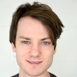
Dr Alan Both is a Senior Lecturer at RMIT University with a background in geospatial and computer science. His research focuses on two areas: developing spatial indicators that quantify the health and liveability of urban environments, such as walkability, access to amenities and greenery, and exposure to urban heat; and adding spatial context to agent-based models. This work underpins transport and health modelling projects including AToM, JIBE, FASTrack and the Transport Health Assessment Tools (THAT), which estimate the health, environmental and economic impacts of infrastructure interventions, often through interactive web platforms.
He has collaborated with organisations including Geoscience Australia, the Department of Energy, Environment and Climate Action (formerly DELWP), the Department of Transport and Planning (incorporating VicRoads) and CSIRO, as well as local governments and the National Growth Areas Alliance. His research has been funded by the National Health and Medical Research Council (NHMRC), VicHealth, the Ian Potter Foundation, FrontierSI (formerly the CRC for Spatial Information) and the iMOVE Cooperative Research Centre.
Dr Both designed and developed the codebase that generates the Australian Urban Observatory’s liveability indicators, led the architecture and development of its current web mapping platform, and continues to expand the Observatory with new indicators and functionality. He is also developing open-source methods to generate transport networks, synthetic populations and travel demand models for regional and metropolitan cities. He teaches geospatial science and supervises PhD students working on urban heat, greenery and transport modelling.
- Spatial analysis
- Agent-based modelling
- Spatial indicators of urban liveability
- Health impacts of transport
PhD in Engineering, 2016
University of Melbourne
BSc in Earth Sciences, 2011
University of Melbourne
BEng (Hons) in Geomatic Engineering, 2011
University of Melbourne
Projects
Activity-based and agent-based Transport model of Melbourne (AToM) is a city-scale multi-modal transport simulation, modelling a full day in the transportation system of Melbourne for understanding intended and unintended consequences of a change in the environment on individuals’ travel behaviour. AToM is an open-source simulation model that to represent mobility on a typical mid-weekday in Melbourne.
AToM includes transportation by car, public transport, cycling, and walking and models travel behaviours at an individual traveller and road segment level. Using the baseline mobility of Melbourne captured in AToM, it is possible to examine impacts of “what-if” built environment interventions on travel behaviour.
The Australian Urban Observatory is a digital liveability planning platform that transforms complex urban data into easily understood liveability maps across Australia’s 21 largest cities. The Observatory draws on over 10 years of policy-relevant research and is located within the Centre for Urban Research at RMIT University.
The Observatory maps key liveability indicators found to be associated with health and wellbeing, and provides a clear understanding of the liveability of cities. The Observatory provides information and understanding to support resource allocation, future policy action and support to create equitable, healthy and liveable places.
The Transport Health Assessment Tool for Brisbane (THAT-Brisbane) was developed as a quantitative Health Impact Assessment model to support evidence-informed planning for healthier cities. THAT-Brisbane extends on the existing and award winning THAT-Melbourne tool and demonstrates health benefits and health care cost saving associated with changing short car trips to walking and cycling.
Both the Melbourne and Brisbane tools quantify the impact of transport choices on health. However, THAT-Brisbane extends on previous modelling by assessing the health impacts on additional chronic diseases and health care cost savings from changing short car trips to active transport modes.
Publications
News
Articles where I’ve been interviewed or my work has been featured